Monday, March 4, 2024

Winterlit festival @ Mountsberg

After my first winter camping in Canada (here), I felt more comfortable getting out in Winter. My driving skills are not ready for primetime winter yet, so, I continue to rely on Parkbus for all my car-less adventures. And, they continue to surprise me with their reliability and consistency, despite the uncertainty in demand.

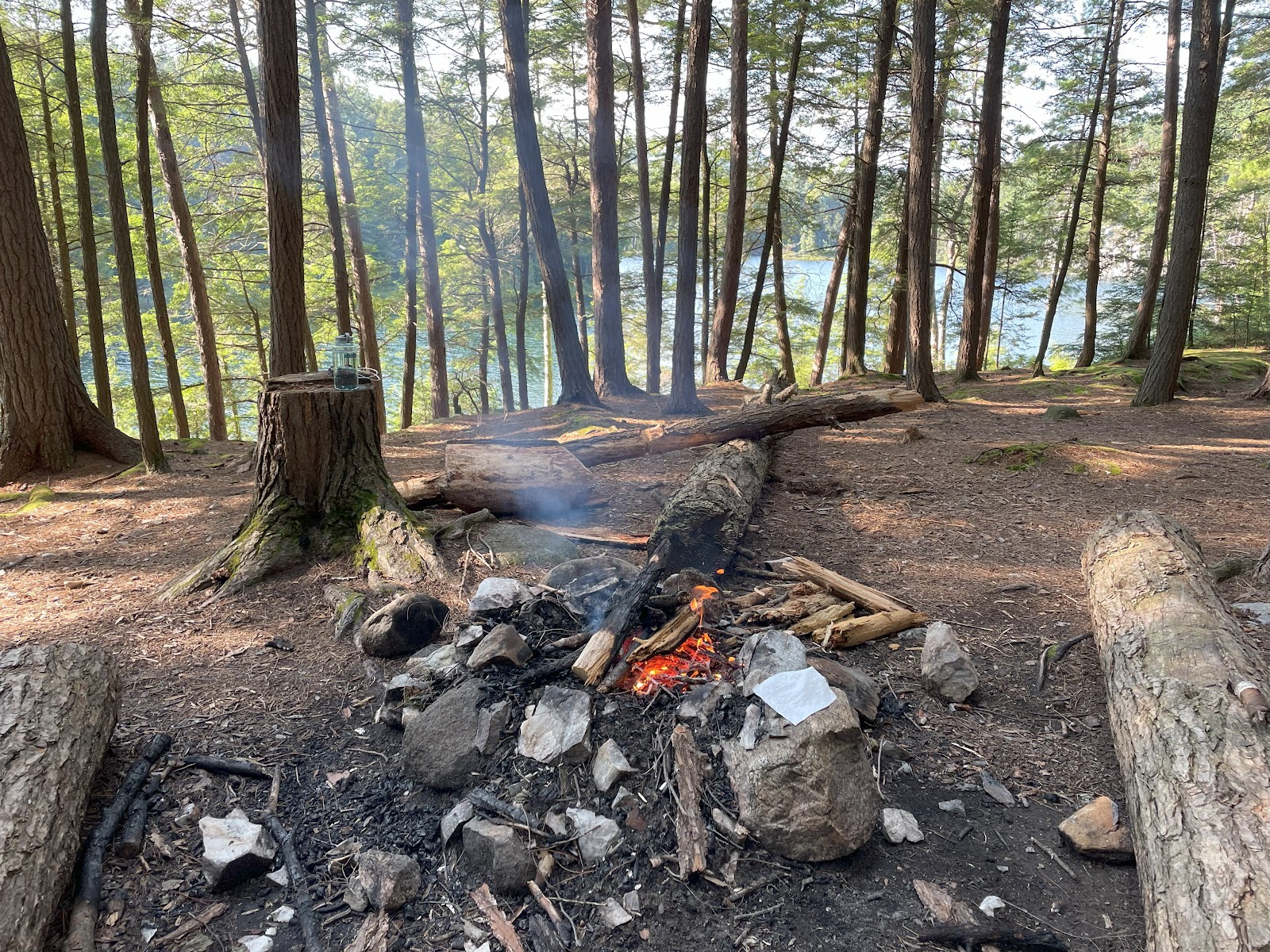
Winterlit is a festival organized by Halton Conservation (here) - two of their easiest trails are illuminated with local art and beautiful lights on Winter evenings. If you are wondering about the cold, they have campfires to warm your sprits and your body. The walk is mesmerizing - the combination of snow, cold temperatures, campfires and twinkling trails makes the experience memorable. When we arrived at the site, we had a couple of hours of daylight, so, as a group, we went on a couple of trails in the village. We were back in the village by sundown. Then began a magical experience...


Monday, February 12, 2024

My first winter camp @ Arrowhead Provincial Park (Part 2 of 2)

This is the final part of a 2-part series on my first winter camping experience in Canada. Part 1, with the gear list, is here

With the gear all set, I was excited to experience Canadian winter first hand. I've skied (never beyond green slopes!) for 4-5 seasons but I always had a roofed shelter to get back to - this was the first time I'd be sleeping out on my own. My previous winter outing was in Ladakh (India) when, at ~-25C, we walked on a frozen lake and camped out in the open. On that trip, I had the support of a hiking group and also logistical support. I was on my own here in Arrowhead Provincial Park...  

Since my driving (<12 months since I got my license) is not winter-ready yet, I decided to make this  into another car-less adventure. There are a few car-less adventures on this blog. 

Day 1 (Jan 14th 2024)

Ontario Northland to Huntsville

  • Toronto Union Station to King City station - GO train
  • King City GO station to Huntsville - Ontario Northland Bus

The pickup at King City station is at the transit shelter at the intersection of Keele St and Burton Grove. There is one more identical transit shelter, near the GO train station and a couple of hundred feet away from the intersection - that is NOT the pickup location. 

There was active weather all through the journey. Check out this 15 second video from the bus:


Once I reached Huntsville, I called one of the local taxis (no uber available), Al's taxi, to take me to Arrowhead Park which was a 15-min ride. Once I reached the site and setup the tent, I got started with clearing snow and setting the site up for dinner. 


Once all the snow (well, let's call it as much as possible) was cleared out, we started a fire with the firewood we purchased from the Park. The wood was damp (surprise!) and it took an effort to keep the fire going. At dinner, my MSR Whisperlite stove malfunctioned - it couldn't give me a steady flame. So, I reverted back to my tried and tested MSR PocketRocket Deluxe, which I carried for emergency use. There was a minor hiccup with the canister sticking to the table after use but we were able to work around it. Overnight, we had ~4-5 inches of snow - not bad at all but it did give us a good feel of what to expect. 


Overall, here is how the gear fared: 

Sleep system: My wife used the Nemo Sonic -20F, I used a couple of summer sleeping bags - we both were warm throughout the night. The tent (MSR Access 2) insulated us well and shielded us well from the snow and cold. There was condensation inside the tent (obviously) overnight - I'd like to try a couple of different configurations to find the perfect setup for this weather. 

Kitchen: I returned the MSR whisperlite on my return to the city. Not a great experience with the stove but I saw a lot of good reviews of it. I might have been just unlucky. On my next trip, I intend to use my summer kit, with some precautions on Canister (like storing it inside the sleeping bag to prevent it from freezing). 

Clothing: I have seen a few Canadian winters, so, I was well prepared with the layers. I wouldn't change anything on clothing for the next trip. 

This was a great experience and another "first". I realized a few things: 

- The gear, described in Part 1, fared very well and it made the experience very enjoyable. The sleep system, in particular, was perfect. 

- I am not ready for back country in the winter yet. I need a couple more "accessible" winter camping trips to learn more. I have always respected mother nature and will continue to do so - I'll wait until I feel ready for the back country. 

More coming soon!!! 

My first winter camp @ Arrowhead Provincial Park (Part 1 of 2)

 I've been wanting to graduate to winter camping for a while. I always knew that it'd be challenging and, in the back country, any situation could easily escalate into a life threatening one. So, I decided to try it out in an accessible provincial park of Ontario (Arrowhead Provincial Park) in the heart of Canadian winter. This allowed some room for gear malfunction and also granted access to emergency services should something go wrong due to inclement winter weather.

Arrowhead is a popular provincial park sitting just outside its bigger brother, and my favorite, Algonquin provincial park. The park has a well established trail system for winter activities and also hosts Fire and Ice nights (more on that here) on the natural skating rink. 

The temperature that day was -12 degree Celsius (-17 with wind chill) or 10 degree Fahrenheit (near zero Fahrenheit with wind chill). And, we had a lot of snow a day before and there was an active warning for more on the day I was to camp. I couldn't have asked for a better night... 

In my research for winter camping, I realized that having the right gear is mission critical. Good gear is important for back country escapades in other seasons as well but you could, potentially without risking your life, overcome malfunctions in the summer/shoulder seasons (see my Highland trek in Algonquin park (here)) with minor workarounds. With winter camping, the margin of error is incredibly thin and a minor error in judgment could easily put your life in jeopardy. 

So, I put in a lot of time researching the right gear - I had to literally refresh every component of my summer camping setup. Here is what I ended up with :

Sleep


Kitchen


Clothing

Base layer; Fleece; Winter jacket (Kanuk, a local Montreal firm - I am a big fan); wind breaker gloves; lightweight 800 fill down jacket for emergency use


Other accessories


In the next part, I'll go into the detail on how the gear fared and also on the overall experience. 


Monday, October 16, 2023

Algonquin Provincial Park - Western Uplands backpacking trail

 If you are short on time and would like to view just the itinerary and the gear list for this Western Uplands backpacking trail in Algonquin Provincial Park in Ontario (Canada), please see this post.

Now that you have to opted to read this detailed blog, I am about to bombard you with all the unnecessary detail, day by day. 

Let us start with my route : 

Trail in yellow, direction of hike in purple, and night stays in red

Western Uplands Backpacking Trail (88kms, 28th July 2023 to 5th August 2023)

Day 1 - 28th July - Toronto to Algonquin Provincial Park (Walk 3KM on the highway, hike ~11KM on the trail; Camp at Steeprise Lake)

As with other car-less adventures in Canada, I relied on the very reliable Parkbus to take me from Toronno to Algonquin Provincial Park. The bus dropped a diverse bunch of hikers (one Latin American traveler, 2 PhDs from Austria and an Indian guy (of course, that is me)) at West Gate right on time at ~11:15AM. West Gate is also known as KM Zero (KM 0) as this is where Algonquin Park officially begins on highway 60. All distances to camping sites and other attractions on Highway 60 are measured from this reference point. 

The other hikers had a long day ahead of them, so, they started the hike immediately. I stayed back to repack my backpack for the trail (travel mode to hiking mode) and set on the grueling 3KM walk on the highway. The last thing you want to do while on a hiking trip is to walk on the shoulder of a highway with cars speeding at ~100Km/hr. 

The trailhead is at km 3.0

I reached the trailhead in ~45 mins and started the hike, not following one of the recommendations which, very specifically, asked NOT to hike alone. To me, there is no better way to experience the wild - so, despite being a very obedient civilian, I choose to accept the risk (with a very detailed, multi-month prep before the hike)

As soon as you start the hike, in a couple of minutes, you come across a fork, where left takes you clockwise and right, anti-clockwise. I took left because my campsites were reserved for a clockwise loop. 

Left is a clockwise loop

The trial was wet and slushy all along. My boot (Lowa Renegade) did a very good job of keeping me dry - I'd recommend a shoe that covers up over your ankle. 

A couple of hours into the hike, another solo-hiker overtook me (I walk slowly and am generally not in a hurry unless absolutely necessary). A few minutes later, I caught up with him and we started a chat. He was from Windsor, Canada and his friend had a last-minute change of plans and hence, he had to do this alone. While we were discussing our plans for the night, we came across a fork, without signage. This is a very rare occurrence - I've found the trails in North America to be very well marked. Both options on the fork seemed plausible - so, we took one trail each and hoped we'll see each other on the other side. That couldn't happen because my trail ended abruptly a few minutes later. I retraced my path to the fork and took the other option. I was surprised to see the hiker from Windsor heading back to the fork - this was strange because I was sure that my trail wasn't the right one and this one had to be the correct path. I was curious to know his story of the route - he mentioned that a sign board indicated that the trail was going down to the lake and didn't seem like the right way. I told him that the trail I took from the fork initial was surely not our trail, so, this had to be it and I convinced him to explore this further with me. A couple of hundred meters later, we realized that it was indeed the right trail. This was one of the two occasions on this trail where the marking could have been better. 

As we neared the campsites, we went our ways and I invited him for dinner since he didn't have a stove (his friend was supposed to carry the stove). I settled in, waited for a while and since he did not return, I assumed that he was able to light a fire. 

For me, the first night in multi-night solo adventures is always the most difficult one. I am generally very anxious, transitioning from a city life into one in the wild. And, fresh bear dropping near my site did not help! 

Here is the view from Steeprise site #2. 

Dinner by the lake

Day 2 - 29th July - Steeprise Lake to Pincher Lake (~16km hike)

There were no incidents the previous night and I woke up to a beautiful morning. I packed up and started my day and in a few minutes, reached the detour for Steeprise Lake site #1 where the Windsor guy was at. I thought about checking in on him but wanted to respect his privacy and decided not to. He seemed experienced enough to light a fire or to get through a night with cold food / energy bars. 

The trail goes through the east of Maggie lake, a very popular site for folks doing one of the shorter loops. It's distance from the highway (~11km - ~15km depending on the campsite) makes it an ideal first night or the last night for hikes from Highway 60. 

The trail has frequent uphill and downhill sections with a few steep corridors thrown in. I had a good flavor of the terrain from my Highlands trek last year. As I approached Clara Lake, I thought of the South American guy who was supposed to camp here for the previous night - it must have been a very long day for him after the bus ride. 

As I reached my campsite, I saw a chipmunk waiting for me. This one, it seems, was fed by the hikers and was accustomed to seeing people and was used to being around with people. I don't feed animals while in the backcountry and, despite the disappointment it caused to the chipmunk, I continued my practice of not interfering with wild life. Earlier in the day, one of the hikers who I met was complaining about chipmunks and squirrels at his site - I was now able to relate to his story. This was night 2 of my trip and If I had lost my food on this night, it'd have been an excruciatingly long hike back to the highway (and that too without food). 

Anyways, I settled in, took a dip in the lake, had dinner and hung my food in a "bear-safe" way and hoped that it'd be as is when I wake up the next day. 

Bear footprint

Pincher Lake Site #3 - Beautiful view of the lake from the site


Day 3 - 30th July - Pincher Lake to Ishkuday Lake (~13km hike)

I woke up to a beautiful sunrise and my food was intact too. I couldn't have asked for more. 

Sunrise from Picher Lake Site #3

The chipmunk (not the one on the left)

Once you cross Pincher Lake, and head North, the trail becomes more isolated when compared to the South. Fewer folks attempt this trail from the Rain Lake access point to the Northwest - Highway 60, where I started, is more popular. Ishkuday was the farthest point on this loop and if I had lost my food to bears (or other wildlife), I'd have had to exit the park via the Rain Lake access point in the North. I was now getting familiar with the terrain and was getting more comfortable in the wild after a couple of anxious nights. I reached Ishkuday in the afternoon. At first sight, it seemed to be a lovely site - however, as I tried to fetch water, I realized that there is no easy access to the lake. If you are prepared to wade through bogs, and submerged branches, you'd be able to get to sediment free water. I decided not to pursue and managed the night on energy bars. Over time, one gets to know what the body needs during extended backcountry trips. With years of hiking behind me, I knew my body well. So, I was not worried about skipping an important meal this night. I conserved whatever water I had and decided to get a refill at Brown Lake the next day. 

Day 4 - 31st July - Ishkuday Lake to West Otterpaw Lake (~10km hike)

Per my plan, I was supposed to stop at Brown Lake for a water refill. However, I decided to make the push to my site at West Otterpaw. This was a short day and I was comfortable reaching my site fairly early in the afternoon and ruminating over my thoughts. Some more bear footprints and droppings but no signs of any wildlife, even on the more remote northern part of the loop. 

I managed to get a fire going for a while with some dead wood from near the site. Couldn't keep it going for long as the wood was wet from recent rain. Nevertheless, it was fun... 


I settled into my site, had a hot dinner and "checked in" like every other night. 

I used Zoleo satellite communicator to send "check in" messages to my wife - The last time I carried a satellite device with me was for the Auyuittuq hike in the Canadian artic. This communicator has 2-way messaging capability as well but I've never used that feature and do not intend to unless it is an emergency. When you press the "check in" button on the device, it sends an SMS message with your GPS coordinates to phone numbers configured before the trip. When the receiver clicks on the SMS message it opens up the location in Google or Apple maps. I found this to be a very useful companion on this "no mobile network" route. 

The device needs to be pointed to the sky


Sample "check in" message from Satellite communicator


Day 5 - 1st August - West Otterpaw Lake to Susan Lake (~9km hike)

On the way from West Otterpaw to Susan Lake, the trail crosses Otterpaw Creek twice. The crossings are beautiful except that you may have to wade through waist deep water at some locations if the bridges are broken. Another beautiful day on the trail came to an end with no incidents - I settled in, hung my food (see below, 2 bags at different locations), and prepared for the next day. 


Day 6 - 2nd August - Susan Lake to Panther Lake (~9km hike)

Got off to a beautiful start to the day with an amazing view of the lake. This view had become a fixture on this trip - I always woke up to out-of-this-world, mist-laden lakes. 


I was also getting used to shorter days and lots of time at the site. The way to Panther was about a 9km hike in a terrain that I was now very familiar with. There was one tricky creek crossing (Lupus Creek, see below) where the bridge was flooded. I had to use my hiking poles as support to avoid getting wet while I scrambled my way through. 

Flooded Lupus creek


Day 7 - 3rd August - Panther Lake to Guskewau (~7km hike)

My initial plan was to head to Norah Lake for night #7 - However, my back was showing some signs of pain and I hate seeking help to get myself out of the wilderness. So, I decided to change the route to go to Guskewau instead - this meant that I had to use the emergency site at Guskewau. I was to camp at this site the next day but decided to try my luck with the bus one day prior. 

Day 8 - 4th August - Guskewau Lake to the highway (~8km round trip)

Instead of waiting 24 hours at this site, I wanted to make a push to the highway so that I can call the bus company to evaluate my choices, if any. Unfortunately, when I called them after reaching highway 60, they informed me that they weren't running the service that day and that I had to wait for my scheduled trip the next day. Now, I had two options: #1, hitch a hike to the nearest town (Huntsville) and try to find my way to Toronto via public transit or #2, go back to the wild for another day (I had a back country reservation through this night) and return for the bus the next day. 

I am well aware of the state of public transit in North America and therefore, decided against option #1. So, I had to reset myself and start another hike back into the wild only to return the next day. 

Day 9 - 5th August - Guskewau Lake to West Gate (~4km hike and ~3km on the highway)

I traced the same path as the previous day to the highway and walked along the highway to the West Gate for my pickup. It was the end of an awesome trip,  and quality time alone in the wild. And, it was also time to get back to the madness! See you soon Algonquin...

Guskewau Lake

Managed to get a small fire going on the last morning


See you soon Algonquin!!


Tuesday, August 22, 2023

Hikes without a car from Toronto - Algonquin Provincial Park - Western Uplands backpacking trail


So, my tryst with Algonquin continues. After my solo backpacking trip to Highland Backpacking Trail (~40KM) last year, I decided to do something longer this year. I did the Western Uplands Backpacking Trail (88KM loop per the park map) this summer - of course, solo again. 


If you'd like to cut to the chase, here is the itinerary and gear list :


ITINERARY

  • Day 1: Toronto Downtown to West Gate, Algonquin Park (ParkBus)

  • Night 1: Steeprise Lake (back country; walk 3KM on the highway, hike ~11KM on the trail)

  • Night 2: Pincher Lake (back country; ~15KM)

  • Night 3: Ishkuday Lake (back country, ~13KM)

  • Night 4: West Otterpaw Lake (back country, ~10KM)

  • Night 5: Susan Lake (back country, ~9KM)

  • Night 6: Panther Lake (back country, ~9KM)

  • Night 7: Guskewau Lake (back country, ~6KM) - Unplanned emergency stop, to try if a bus ride is available for my ride back the next day. I had planned for Norah Lake for this night. 

  • Night 8: Guskewau Lake (back country, ~8KM on the trail and 4KM on the highway) - This was the scheduled stop at this site; Walked to the highway to get cellphone coverage so that I could check if a bus is available. It was not, so, had to walk back to the site. 

  • Day 9: Bus from West Gate, Algonquin Park to Toronto Downtown (~4KM on the trail and 3KM on the highway) (ParkBus)

GEAR LIST (Total pack : ~16kgs including food and water)


  • Food : Dehydrated food (multiple brands), energy bars, electrolyte tablets, energy gels; 2 1L water bottles

  • Emergency : Zoleo Satellite communicator (my first-time with this one, worked like a charm for "check-in" messages) ; Swiss knife ; Sol Emergency blanket ; Sea to Summit ultra-sil daypack ; North face down jacket (for an unforeseen cold night out without the tent) ; 3 extra meals for unplanned extension of the trip; One 3.9oz (net weight) MSR Fuel canister


  • Clothing : 2 Base layers; 1 hiking shorts and 1 hiking pant; Backpacking towel; Rain Jacket; mosquito net for the head; underwear

  • Footwear : Lowa Renegade hiking boots; one sandal pair for creek crossing (learnt a lesson from Highland trip - had to wade through water in that trip); 3 pairs of hiking socks

  • Medication : Tylenol 500 mg, Anti-histamine (prevent insect-bite infections), insect repellant spray, water purifier tablets; band-aid (burns), band-aid (bruises), after-bite cream (insect bites)
 

A detailed write-up is here and a video log is coming soon. 


Monday, September 19, 2022

Hikes without a car from Toronto - Algonquin Provincial Park - Highland backpacking trail

I can't believe that I have survived this long without a car (and, without knowing how to drive!) in North America. And, that has forced me to find ways to get to where I want to with public / shared transport. It has made me tremendously patient - you'll know what I mean if you've ever used public transport in North America outside of major cities. 

I moved to Canada in 2020 in the middle of Covid, pre-vaccination and when lockdowns were widespread. Almost all of 2021 passed by without much action. In 22, I wanted to get back to some form of normal like everyone else. For me, normalcy meant hunting down hikes within reach of public transport. I stumbled upon one of the best parks in the country, Algonquin Park in Ontario. ParkBus runs a point-to-point service from Tronno (what's in a name anyway!) to Algonquin. They were a godsend for people like me. I can't thank them enough for continuing to operate this summer. (I used a similar service in the US for skiing (Ovrride)). A video blog on this Algonquin trip is below and detailed itinerary follows: 


Detailed Itinerary:

Day 1: Toronto Downtown to Algonquin Park (ParkBus)

Hike to Provoking Lake from Lake of Two Rivers Store (Bus drop-off / pick-up point)

Night 1: Provoking Lake (back country)

Night 2: Harness Lake (back country)

Night 3: Head Lake (back country)

Night 4: Provoking Lake (back country)

Night 5: Lake of Two Rivers Campground (car access available to campground)

Day 6: Bus from Lake of Two Rivers Store to Toronto Downtown (ParkBus)

A detailed blog on my thoughts during this solo trip in bear country is still wrapped up in my mind and when I do manage to get it out, it'll be out here on this blog! 

Tuesday, September 13, 2022

Time to reset

It has been a very unusual past few months for all of us. We'll never forget 2020 in our lives. 

As I look back at this year, it feels as if the "sorry, I was on mute" on zoom calls applied to our lives as well. It has been a year of learning (to fight a pandemic), yearning (to live more), and appreciation (of what we had before entered this period). It was a year when the underlying cracks in our societies surfaced, dysfunctional political systems emerged and people united for common causes. 

The real question is how do you unmute safely and we all have our own answers based on our risk appetite.  

But, here we are at the end of the tunnel. Time to look forward. Time to reset our lives to the new normal. 


Saturday, July 11, 2020

Running is...


... Everything listed below

... living in the moment and focusing on one step at a time. I remember crossing Thorung la pass in Nepal (~17,800ft) and telling myself to focus on one step at a time. That was easily the most challenging hiking day of my life.  

... pushing yourself harder each day. You add a hundred metres everyday and voila!, in ten days, you have added a km to your routine. I used to struggle to complete 3 km a few months ago,  and now I do 8+kms (~5+ miles) everyday these days.

... to keep pushing forward, one leap at a time and to not stop when your body tells you to. I remember the struggle I had on Capitol Peak in Colorado - I was lagging behind all the time because I was not prepared to keep pushing forward. My body was not used to it at that time. Ten years and a few gray hairs later, things are a little different. 

... to get lost in the music in your ears. As Yanni builds up his tempo, so does my run 

... to observe the world around you as it passes by. Sometimes, it feels like each run is a time lapse of your entire life and you are just a witness looking at all the fun and laughing at the awesome ride you had

... to share the stories of people whom you come across. Each person you come cross has a story, a success, a tragedy and a rich life - you just keep wondering what those events could be. 

... forgetting yourself, even if for a few brief seconds along the way. Along the run, there are always moments when you are completely lost in a thought or in a thoughtless moment - these are the ones I always look forward to. Paradoxically, these moments during the run let you detach completely from the act of running and that, to me, is fulfilling. 

... to let your body switch on autopilot and to detach from it. Your body is a great machine. You oil it well and it keeps running without giving you trouble. Most of the days you run, each step you take is a subconscious activity and your body just takes care of it so that you could focus on better things. On one of those autopilot days in Mumbai, I was bitten by a stray dog and had to take rabies shots! At least that is not a consideration here in NJ/NY...

... feeling your sweat burn your eyes. Oftentimes, the autopilot makes you forget that there are maintenance activities that need to be completed and the body reminds you to wipe your sweat by burning your eyes a bit.  

... to wake up before sunrise and to feel child-like happiness when you see the sun rise half way along the run. I have been fortunate to find a peaceful, not so busy running path near my apartment and each time the sun rises, it brings along the sense of a new beginning. I have a few pictures below. 

... to feel the rain, your sweat, body heat and the cold breeze at the same time. On days when you are caught off guard, you get to feel all these items at once. 

... realizing the power of "now". Getting lost in the moment is not that easy and is often underrated. I consciously run the same path(s) every day to ensure that I get lost in my thought.

... to disconnect from yourself to find your true self. Yeah, this one is cheesy. But, the act of disconnecting from everything else is indeed finding yourself. 

-----------------------------

Keep running. Be driven. Do whatever that makes you feel the above...


All pictures are views of Manhattan from Jersey City, taken during early morning runs.


Monday, July 6, 2020

The united colors of humanity


It has been more than a decade since I wrote about race (the brownie sizzles here). 

In these 10+ years, 
  • I have grown wiser (due to lack of evidence suggesting otherwise); My hair has evolved into a new color (for better or worse); I have experienced two bitter cold Canadian winters, the cosmopolitan life of Singapore, a failed startup in India and most recently, the Corona virus in the US (well, across the globe)
  • I have lived in 
    • A multi cultural university locality in 'French first' Montreal, where you are welcome with open arms the moment you attempt speaking in French,
    • A predominantly Asian Singapore, where my Singaporean Physio and I got into a debate over Chinese vs Singaporean identities,
    • A tier II Indian city called Pune where my wife had to say "Mein Japani hoon" to identify herself as Japanese (the phrase translates to "I am Japanese"),
    • The cultural hotspot of New York / New Jersey where people were too busy with their lives until the virus struck and made people think.
Each one of these experiences had racial underpinnings that gave me perspective. Be it Montreal where, without French, you are treated like an outsider or Singapore where Singaporeans uniquely identify themselves or India where anyone a small nose is called a "Nepali" or "Chinese", each one of these experiences showed me the impact of conscious and unconscious bias against people of certain characteristics.

The recent events in the US have made me think about the future of humanity as a whole. And, the Black Lives Matter (BLM) movement is just the tip of the iceberg - across the world, we have systemic issues of discrimination within castes, races, colors, religions and countries. Makes one wonder if we are a self destructing race and Musk, foreseeing this, is aggressively pursuing another planet to destroy. 

History, in the absence of a better guiding post, acts as a good reference point to gain perspective.  Machines evolve as they accumulate more history. However, we seem to be going backwards with time. Makes machines better candidates for evolution than us - Maybe Darwin knows better. 

Nevertheless, let us try to understand race by looking back at history.

4,000 Million (Mn) years ago - Life on Earth
~500 Mn years ago - Animals
~200 Mn years ago - Mammals
~50 Mn years ago - Monkeys
~10 Mn years ago - Close human relatives
~200,000 (K) years ago - Homo Sapiens
~50K years ago - Modern humans emigrate from Africa

As we can see, we have not been here for more than a couple of hundred thousand years and in the larger scheme of things, we have done more damage than potentially any other species. In the most recent 50,000 years, as humans migrated to different parts of the world, Darwin's natural selection took over and ensured that we adapt to the new environments. 

Evolution since the grand migration

We all know that human skin color is affected by, among other things, the amount of melanin. As humans migrated from higher UV exposure (near equator) to farther areas, lighter skin types evolved. 
And, with the invention of agriculture ~12,000 years ago, we started settling down as there was no more a need for a nomadic lifestyle. This resulted in a change in human genome which altered height, immunity, skin color etc. over a period of time. 

As humans moved into colder climes, the noses evolved to become smaller to accommodate colder, drier air which irritates the nasal membranes.  

Similar changes in body structure, immunity came across as we adjusted to the new environments. This was natural selection working its way through. 

The most recent history revisited 

With the above background, now, let us look at the events that have taken place in recent history.  

1700s
  • 1707 - United Kingdom of Britain was formed. This was a key event that resulted in colonization of the world
  • 1757 - Beginning of the British empire in India
  • 1776 - American declaration of Independence;  America celebrates 244th anniversary in a unique set of circumstances this week.
  • 1789+ - French revolution that leads to Napoleon becoming the First Consul
Overall, the 1700s set the foundation for colonization with France, Britain and Russia leading the way. 

1800s
  • Across US and Europe, show of power continues. 
    • US executes Louisiana Purchase, and doubles its territory with more acquisitions. 
    • In Europe, Napoleon extends his reign until 1814 when France is defeated and Napoleon is exiled.
  • 1824 - Mexico gains freedom from Spain
  • 1833 - Slavery is abolished in the British Empire
  • 1861 - US Civil war begins
  • 1867 - Japan ends 675 year old Shogun rule
  • 1868 - Civil rights granted to blacks 
Throughout the 1800s, there is debate on equal rights and slavery and significant progress is made.

1900s
    • 1914-1918 - First World War
    • 1919 - Mahatma Gandhi initiates his non violence movement against the British
    • 1930s - The great depression
    • 1934 - Hitler becomes Fuhrer
    • 1939-45 - Second world war
    • 1960s - Unrest in the US over black rights. Martin Luther King Jr. rises as a leader but is assassinated in 1968.
    • 1969 - Gay Rights Movement in New York
    This century saw numerous conflicts and wars, fights for freedom resulting in the end of colonization and birth of new, free countries. Significant progress was made with respect to equal rights, be it for women, African Americans or gays. This century also saw the rise of great leaders and visionaries like Martin Luther King Jr, Mahatma Gandhi, Nelson Mandela, Mother Teresa etc. 

    2000s

    We experienced the rise of the internet, a force that changed the order of life on this planet. Other key events include 9/11 attack on the World Trade Center, the financial crisis of 2008 and an overall economic boom across the world. 

    Putting it all together

    Agree, that was a lengthy history - but it was necessary. 

    We evolved from simplistic bacteria to very complex homo sapiens. And then, with the invention of agriculture, we transitioned from nomadic beings to stationary settlers. And post that, with all this time on our hands, we started inventing things to improve our lives. We ventured into other geographies, created colonies and subsequently, gave birth to countries with bubbling economies. And, while we were busy doing all this, evolution was working its own vicious plot in the background - it created  variants of homo sapiens that were better suited for survival.

    If we look at the most recent couple of hundred years, we have transitioned from slavery and colonialism to a mostly democratic bunch of diverse countries. Rights for women, people of color, and people of various sexual orientations have significantly improved during this period. 

    While the recent events in the US do indicate that criminal justice has lagged behind in treating blacks fairly (RIP George Floyd, Breonna Taylor, Ahmaud Arbery), there have been great strides forward in terms of education (~24% under 25 complete their bachelors), representation of African Americans in the US congress (~11%) and other areas here in the US. The rise in education will lead to a rise in wealth and help bridge, to some extent, the income inequality that exists today. It might be a good idea to set diversity targets for corporations, local governments based on the population mix of the region in which they operate. I am sure there are better brains working on this one. 

    Let us now take a step back and consider the whole of humanity - somewhere along the process of evolution, we lost the ability to accept differences. We have so many examples in recent history but we somehow find it difficult to learn - Shia muslims fighting Sunnis in the middle east, scheduled castes treated poorly in India, China angering neighbors with petty border issues, natives and indigenous tribes being sidelined etc.  And now, most recently, the Black Lives Matter protests to fix the criminal justice system. 

    All these wars, conflicts, protests must drive home the point that we don't gain much by fighting against one another. We would be better off if we accept the natural order of things i.e. the diversity arising out of evolution and work towards embracing differences. If these BLM protests morph into a movement that addresses the perennial issue of our collective inability to accept diversity, it would be a giant leap forward. And, once that happens, Darwin would be a happy man! 

    --------------------------------------------

    References:

    Friday, July 3, 2020

    Day hikes/trips from NYC without a car - Part III - Wildwood State Park


    This is the first time I ventured into Long Island. All my previous trips have been to the Hudson valley. 
    (In the NY state map below, #8 is Hudson Valley region and #10 is Long Island)


    As always, since we are traveling without a car, let us start with the commute. 

    THE COMMUTE:

     1. Get to Penn Station in NYC

    From Jersey city / rest of New Jersey 
    • Path takes you to 33rd street, from where Penn Station is a few minutes walk.
    • NJ Transit takes you to Penn Station. 
    From NYC, you know how. Take any of the subways that leads you to Penn. 
     
    Of course, if you have more dollars to spare, use Lyft or Uber to get to Penn. 

    2. Take the Long Island Railroad to Riverhead

    You have, in general, 2 options to get to Riverhead. 

    Option 1: Take the train to Greenport and get off at Riverhead. Please check the latest schedules - Long Island Railroad (LIRR) is operating limited lines due to Covid. 

    Option 2: Take the train to Ronkonkoma and then transfer to the train to Greenport and get off at Riverhead. 

    The option you choose will depend on the time you reach Penn station - so, it is very important to plan ahead. Pick the train you want to take for your onward and return journeys before you begin the trip. 

    LIRR's map is here

    Riverhead looks like this - well, nothing fancy or noteworthy, just that I had a photo taken so why not throw it at you!


    3. Take Uber / Lyft to Wildwood State Park

    The journey is about 10 miles / 15 mins and you will pay approximately $15 for the ride. I had an interesting conversation with my Uber driver. He had lived 50+ years of his life around Riverhead and didn't know about this park! And, here he was, driving an Indian who lives in another state, took multiple trains to come to this place. As I was thinking about this conversation, I realized that it all goes back to our desire to look for exotic locations away from home. Maybe we should start appreciating our home a little more. I guess the Covid pandemic has forced us to do just that. Your home has become everything it is not supposed to be and in a way, this has made us appreciate a lot of small things which were otherwise taken for granted.  Well, more on that later, let us get back to Riverhead.

    Across all my car-less hiking trips in the US, I have hardly seen anyone using Uber or Lyft for national/state parks. Of course, this is not a factual statement but just my opinion based on the number of people I have seen waiting for cabs. Wiki has an extensive page for the number I am referring to.

    Therefore, I would recommend you to tip more than normal as the driver is not going to get another ride back to town. I always do that when I take Uber or Lyft for the last mile. This is the least we can do to support local communities. 


    THE HIKE:

    The trails are very well marked, and there is hardly any elevation gain or any signs of tricky terrain. This one is accessible to all skill levels. Most of the folks who come to this park come here for the beach. The beach is clean and can be a good detour from the trail if you would like to scramble your way to the water. 


    I didn't see a lot of folks on the trail. The trails are well marked and you can do whatever length suits you fine. I liked the solitude and the peaceful setting on a beautiful, sunny day. 


    I almost walked on every trail possible and once bumped into a private property along the park. 


    And then, once you are done, you take an Uber/Lyft back to Riverhead train station to get back to your 5 day migration !!


    -------------------------------------------------------------------

    This is part III of a 'car-less day trip/hike around NYC' series. Previous blogs are listed below:


    Monday, June 29, 2020

    Day hikes/trips from NYC without a car - Part II - Breakneck Ridge


    This is the second blog in the series. The first one was Arden Point and Glenclyffe  

    Breackneck Ridge is easily the most intense day hike in upstate NY. It is a steep ~3-4 mile round trip hike. It is strenuous and I would not recommend this one for first time hikers. Also, this trail is not pet friendly, please try yourself before taking your pet. 
     
    THE COMMUTE

     1. Get to Penn Station in NYC

    From Jersey city / rest of New Jersey 
      • Path takes you to 33rd street, from where Penn Station is a few minutes walk.
      • NJ Transit takes you to Penn Station. 
    From NYC, you know how. Take any of the subways that leads you to Penn. 
     
    Of course, if you have more dollars to spare, use Lyft or Uber to get to Penn. 

    2. Take Metro North, Hudson Line (Green Line) from Penn to Breakneck Ridge. 

    Please note that the train schedule is different for weekdays and weekends, when you have more trains stopping at Breakneck Ridge. Please check Metro North schedule before you plan.
    • You can buy tickets at Penn station or
    • Use the MTA eTix Mobile App (most convenient) or
    • Buy ticket on the train with cash (more expensive than station and app). I haven't seen card machines with ticket collectors, so please ensure that you have sufficient cash and change, if you choose this option.
            I always use the MTA eTix app - It is very convenient. You can book the ticket whenever you want (I do it when I am on the way to Penn). Activate the ticket after boarding the train - DO NOT activate before boarding. Once you activate your ticket, there is no way to reverse the action and the ticket is valid for the time period of the journey. You have to present the app if demanded by the ticket collector, so ensure that you have enough battery before you activate. I have seen an example where someone's battery ran out and had to buy a new ticket from the collector.


    3. Once you reach Breakneck Ridge, walk to the trailhead

    • Facing the direction of the train (i.e. North), get to the right side platform. I have been dropped on the right platform on the 2 trips I made. 
    • Once you are on the right platform, walk through the the only exit to route 9D 
    • Without crossing 9D, turn to the right and walk for a few minutes along 9D. 
    • Just before the tunnel, you will notice a small registration center (during summer). Even if you don't see it, the trailhead can be easily seen before the tunnel. DO NOT cross the tunnel - The trail will take you over the tunnel. 

    THE HIKE

    The trail begins on route 9D before the tunnel and gradually takes you over the tunnel on to the rocky sections ahead. The incline increases gradually as you move forward. Once you enter the rocky section, please be careful of rock falls initiated by fellow hikers ahead of you. You have to scramble through vertical rock sections on this hike, please wear appropriate clothing. 


    This hike is immensely popular and gets really crowded on summer weekends. And, the crowds come here for a reason - Breakneck Ridge offers stellar views of the Hudson river. 


    The first view point offers a beautiful view. Don't mistake it for the summit, there is more to go. The views get better as you go higher. 


    On an average, it takes about 4 hours for the round trip back to the station - Please plan accordingly. You could do much more depending on how much energy you have left. 


    In the trail above, I have marked the starting point (i.e. breakneck train station) in a red circle. A few trail options are marked in blue: 

    Option 1: Easier, shorter - BR-UC-BK

    Option 2 : A little longer but ideal for a day hike : BR-BB-WM

    [BR, UC, BK, BB and WM are trail IDs. Details are in the link here)

    Of course, you can always continue on to Beacon towards the North or Cold Spring to the South (not marked by me, there are multiple options). On one of my trips, I took Option #2 above and then took a cab to Beacon - you can enjoy a drink in this historical city and then take the train back to NYC.

    ---------------------------------------------------------

    Earlier blogs in this car-less, NYC day hike series :


    Sunday, June 28, 2020

    Day hikes/trips from NYC without a car - Part I - Arden Point and Glenclyffe


    I don't own a car. I don't know how to drive one. 

    These constraints make me evaluate car-less hiking alternatives wherever I live. As my current stint in NYC comes to an end, I thought, this might be a good time to document the trips I made. 

    This blog is the first in the series. 

    So, why Arden point and Glenclyffe? 
    • This is a good start for anyone who wishes to start exploring the region around NYC. 
    • Easy trails - if you can walk, you can do this one.
    • Reasonably well marked trails - A couple of areas are not very well marked but you would never get lost. 
    • Less than a couple of hours by train from NYC

    THE COMMUTE

    1. Get to Penn Station in NYC

    • From Jersey city / rest of New Jersey 
      • Path takes you to 33rd street, from where Penn Station is a few minutes walk.
      • NJ Transit takes you to Penn Station. 
    • From NYC, you know how. Take any of the subways that leads you to Penn. 
    Of course, if you have more dollars to spare, use Lyft or Uber to get to Penn. 

    2. Take Metro North, Hudson Line (Green Line) from Penn to Garrison. 
    • You can buy tickets at Penn station or
    • Use the MTA eTix Mobile App (most convenient) or
    • Buy ticket on the train with cash (more expensive than station and app). I haven't seen card machines with ticket collectors, so please ensure that you have sufficient cash and change, if you choose this option.
            I always use the MTA eTix app - It is very convenient. You can book the ticket whenever you want (I do it when I am on the way to Penn). Activate the ticket after boarding the train - DO NOT activate before boarding. Once you activate your ticket, there is no way to reverse the action and the ticket is valid for the time period of the journey. You have to present the app if demanded by the ticket collector, so ensure that you have enough battery before you activate. I have seen an example where someone's battery ran out and had to buy a new ticket from the collector.


    3. Once you reach Garrison, walk to the trailhead 
    • Facing the direction of the train (i.e. North), get to the right side platform. I have been dropped on the right platform on the 2 trips I made. 
    • Once you are on the right platform, with the railroad behind you, walk towards the right on the road in front of you. It is not more than a 2-3 min walk. So if you have walked longer, you have missed it. 
    • Look for this sign - this is the trailhead. The trail begins to the left of this sign board. 


    THE HIKE

    It is a fairly easy hike with some good views of the Hudson river. You could literally walk anywhere there is a trail and not get lost. Even if you go off the trail, it is very difficult to get lost. There are some key landmarks :

    The first one is a bridge that takes you over the railroad. 


    The next one is the river. 


    Between these 2 landmarks, even if you get lost, you could find yourself !!


    On my first trip, I tried completing the Glenclyffe loop, but could not complete as the trail was blocked with very dense vegetation after this lookout / dilapidated camping spot. I scrambled my way to a private property and then back to the main road that leads to the station.


    This place is not that crowded - I have visited on weekends and have found just a few people. If you would like some solitude without straining yourself that much, Arden Point and Glenclyffe is a very good option. 

    Up next : Breakneck Ridge.